A new emergency evacuation route plan for Nanoose Bay has been established.
The report of the Electoral Area E (Nanoose Bay) evacuation plan, completed by ISL Engineering and Land Service, was presented at the electoral area service committee meeting on June 9.
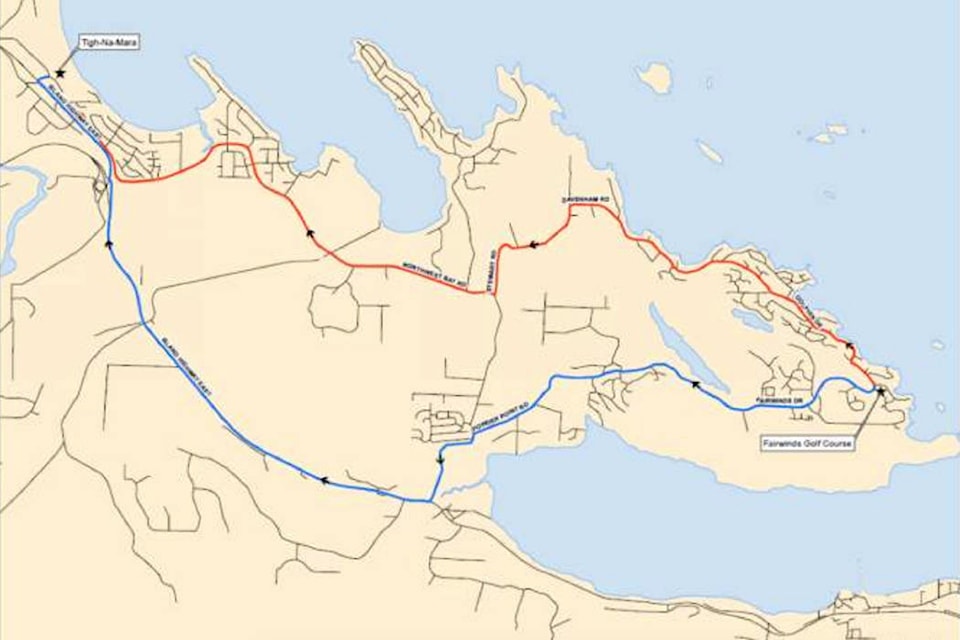
It identifies safe evacuation routes, minimum times required to evacuate and factors for the Regional District of Nanaimo to consider and prepare for during an evacuation. These include placement of traffic control personnel and equipment, information, muster checkpoints and signage, transportation buses, phased evacuation approaches, co-ordination with private landowners and responding agencies, direction of evacuations, traffic signal controls and general readiness messaging.
Area E director Bob Rogers endorsed the plan and credited the thorough work done by RDN staff members and ISL.
“It gives a challenging outlook with respect with the amount of time,” Rogers said. “So it’s going to take co-operation from all agencies once it’s needed.”
According to the report, the primary event that would likely require evacuation is wildfire. Nanoose Bay has a solitary route in and out and in the event of a mass evacuation, a bottleneck is likely to happen on the road and delay emergency response times.
READ ALSO: RDN looks at ways to get residents out of Nanoose in case of emergency
READ ALSO: B.C. prepares for emergencies, evacuations under COVID-19
“This sort of a report I think help our own planning department work forward and have a tool that can be a teaching tool for everybody including the public,” said Rogers. “I think it’s good that the public will know that this report is out there and they can come forward and ask questions of staff on it. It will be a good thing to have.”
The evacuation route plan will be incorporated with the area’s emergency plan. The project was funded through the Union of BC Municipalities Emergency Preparedness Fund.
Electoral Area F (Coombs, Hilliers, Errington, Whiskey Creek, Meadowood) director Leanne Salter said she too has some concerns, and asked if there is a plan to do the same in her area.
Emergency services manager Catherine Morrison said they’ve prioritized the areas they need to work on and apply for funding. That includes Areas F and G (French Creek, San Pareil, Little Qualicum, Englishman River).
The committee endorsed the evacuation route plan, to be recommended to the RDN board for approval.